Archive for the ‘Nearby’ Category

Historic OS Maps in Google Earth

Monday, November 8th, 2010

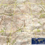
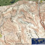
Thanks to the people at getmapping.com, who have taken the Historic 1940s OS Maps available at NPEmap.org.uk, I hearby present:

Historic OS Map layer for Google Earth.

This loads up a layer of Historic New Popular Edition (mainly) maps, onto the 3D Google Earth globe. This is made possible because the original maps are over 50 years old and hence the Crown Copyright has expired.

The getmapping.com WMS service only includes (Most of) England and Wales, no Scotland.

The scans themselves are (c) npemap.org.uk and licenced under this Creative Commons Attribution-NonCommercial Licence 2.5.

(Don’t forget to select the ‘OS Map’ layer, and drag the transparency slider!)
Full UK postcodes in the API!

Friday, April 30th, 2010

Thanks to OS Opendata, the Nearby Converter API now can convert to and from full Unit UK postcodes!

So as not to break applications expecting Sector postcodes in the API, there is a new API endpoint:

http://api1.nearby.org.uk/api/convert.php

API requests against this domain will give the position of the full postcode, and also reverse geocode (return you the nearest) full postcode!

- The Original URL for the API is still available – and will continue to be. I’ve also taken the opportunity to add a version number to the URL. It’s been 4 years since I created this API, and learnt lots in that time, so should be able to create a better version 2 :) When introduce that don’t want to break compatibility.

Of course the ‘Coordinate Convertor‘ is now using CodePoint Open too – the end of having to pay a commercial provider!

(sorry this has taken so long, OS Opendata was introduced at the beginning of the month!, its been a busy month)

Will take the opportunity to duplicate the copyright message:

Contains Royal Mail data © Royal mail copyright and database right 2010.

As it serves as a useful thank you, for making this data available.

Geocube Geograph Clusters in Google Earth

Wednesday, July 15th, 2009

It’s about time did some Google Earth hacking, so thanks to the people at Geocubes, have made a new interactive layer for Google Earth.

Geograph Google Earth Clusters

This works in a similar way to the Geograph SuperLayer, by showing coverage overview, and then zooming in to reveal more detail. The Geocubes layer has the advantage that the clusters work into a closer zoom, and updates to the geograph database make it into the layer within hours. The SuperLayer is slower updating (weeks), but navigating should be much quicker being as its based on KML regions.

You can view also a Google Maps based version of the layer, using the Geocubes API directly.

This is only version 0.1 – there is more to be done – including being able to filter the results based on words and contributor, but this is exciting enough on its own. Once done a bit of work on tidying up the code plan to release it so others can use the geocubes service to create their own layer like this :) Watch this space!

Geolocated websites on the go?

Monday, June 22nd, 2009

Want to quickly access location based websites, while on the go?

Then enter:

m.nearby.org.uk

into your mobile browser.

Very privative, only goes to the nearby location links service, and a few pages on geograph. But between them give access to a fair number of (UK esp) websites.

Disclaimer: Only tested on a Google Android phone so far. Doesn’t seem to pickup GPS position (yet). To be honest surprised not found something like this in the Android Market.

If works out will probably add direct links to other websites, and possibly make it configurable so can choose which sites to show :)

Multi Destination Routing + Altitude Profile

Friday, May 8th, 2009

There is a tool on nearby for taking a multi destination route – and loading it into Google Earth. It was also used to load directions into a “My Map”, but thats basically redundant now, but as the script just converts the directions to a KML file, there are many useful things that can be done with it…

Such as plotting an altitude profile with gpsvisualizer.com***, but to make it even easier, have added a button to the page, that links direct to the form on gpsu with the data prefilled as well as the ‘add altitude’ option enabled.

Enjoy! (Oh and let me know if there are any other interesting destinations would like to load the KML file into!)

Multi Destination Routing Toolkit

*** which Adam recently added the functionalty to add alitude automatically – previsoully a problem as the KML files from Google maps dont include altitude

Grid References on Google Maps

Saturday, September 27th, 2008

I made this ages ago, but forgot about it. And as I havent said anything on here for a while, I’ll post it now just to fill the void. Its a simple mapplet that allows jumping to the location on Google Maps by Grid reference, as well as displaying the GR of the clicked point. KISS

GB and Ireland Grid References Mapplet

Thanks to Lordelph for the Javascript (but I notice that links to a version hosted here!)

Google Earth 4.3: Magnetic Compass

Friday, August 1st, 2008

A while ago released a Compass Overlay, which (hopefully) makes reading directions of the navigation control easier. Well this new version does the same, but its (mostly) correct for the Magnetic Direction!

Magnetic Compass correct link this time!!

Note: its positioned to fit the navigation control of Google Earth 4.3, not the separate compass, which has only recently begun working for me… Updates a few seconds after stopping moving.

Now have a way to determine the magnetic variation at a location have some other ideas for using this in Google Earth, eg magnetic bearing along a line, but this is a starting point. For example in the uk the variation is often too small to be really seen on the tiny control.

Thanks to heywhatsthat.com for the pointer to a webservice that gives the variation.

Update: Rather embarrassingly just noticed the link above was wrong! It was to a static compass. The link above has been updated, and it should now rotate! Sorry for confusion… (always wondered why this didnt get much traffic!)

Google Earth: Flight Simulator GPS Arrow

Saturday, July 26th, 2008

Behold a new network link from nearby.org.uk:

Google Earth GPS

Once you have chosen a destination point, a small arrow will be shown in the bottom right of your Google Earth window, which points towards your destination! Ideal for use in the flight simulator, where you can play follow the arrow.

Note it only updates every 5 seconds, and comes with all sorts of disclaimers such as don’t use in life or death situations.

absconding to Ireland and feckups at the hosting

Friday, July 11th, 2008

Sorry that nearby.org.uk and related services have been offline for most of the past week. I am currently away for a trip in (not so) sunny Ireland, and the first halve was camping so was away from Internet connectivity.

Anyway minutes before I went away I got a deluge of emails saying the site if offline? what?? It turns out my generic credit card had expired, and without warning (feck) the machine was switched off. But this was 12am so their phone lines where closed (billing at least) – so a hasty phone call on the move in the morning and with the new card details they said be back within a few hours – not ideal but the best could do. I carried on my merry way and didn’t think any more of it (my mistake!), but the real feck up was that yes they had re-enabled the machine, they just forgot to re enable it at the switch…

It appears to be back now after much international phone calls….

btw – feck isn’t considered a swear word in Éire, and when in Ireland, do as the Irish do. (which is use it a lot!)

Update: as an amendum to the above, it turns out that on wednesday (3 days after it was switched off) a letter did arrive at home stating that they intended to turn off the server unless payment was received – and that it would take three days to reactivate the server. Which is at least factual.

Letting your KML loose

Thursday, June 26th, 2008

I think I have mentioned this before, but have a page that helps share your KML file via various Google services.

Following a post on the Maps help group, realised could update it with some other ways to use the KML (even non Google!)

So view the latest page at

Publishing your KML for Google Earth, Google Maps and Beyond

suggestions for other links welcome in the comments!