Posts Tagged ‘Google Maps’

Preservation of the Google Maps Directory

Saturday, December 18th, 2010

Recently Google deprecated Mapplets, which are little applications that ran on Google Maps. They have also now removed the Google Maps Directory.

However its still possible to run mapplets by a dedicated page (well at least for as long as V2 of the Google Maps API exists) – but no listing of mapplets available within Google Maps.
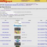

But fear not, I captured a copy of the mapplet list, and created a small crawler to fetch the details from the mapplets, and present them in a little searchable application:

Replacement Mapplet Directory

Admittedly the quality of the applications in the directory where always kinda variable, but there is some real gems in there, so at least preserving a listing I think is worthwhile, so they can be accessed if needbe.

Google powers your GeoDatabase

Sunday, December 13th, 2009

Update: Dec 16th, Offical Blog post is out. And just for interest a TechCrunch post too.

Sometime recently* Google has added ‘geo-filtering’ and attribute filtering to the Google Maps Data API, I haven’t seen any announcement of this or other mention (if it was, it was below my radar), other than a tiny footnote in an Article about doing geo-queries on AppEngine.

Anyway for people not aware of the Google Maps Data API, its basically a programmatic access method to the ‘My Maps’ feature of Google Maps. So with the API you can use Google Maps as your Geo-Database. (Subject I believe to a limit of 10,000 features per ‘Map’, but can have many maps)

However it wasn’t all that useful, as all you could do was inject your data, or read it all back. But now that searching and filtering is possible, it makes the API a viable method store your data for a Google Maps API or similar mashup. As soon as you get beyond a trival number of markers, you need to store your data in a database, and being able to only fetch the features in the current viewport is a good way of only working with a small subset at once.

Curouslly, there doesn’t seem to be a ‘limit’; so a big bounding box, could potentially still access many features. But hopefully that will be rectified soon.
Update2: Seems there is a max-results : handy!

Grid References on Google Maps

Saturday, September 27th, 2008

I made this ages ago, but forgot about it. And as I havent said anything on here for a while, I’ll post it now just to fill the void. Its a simple mapplet that allows jumping to the location on Google Maps by Grid reference, as well as displaying the GR of the clicked point. KISS

GB and Ireland Grid References Mapplet

Thanks to Lordelph for the Javascript (but I notice that links to a version hosted here!)

Letting your KML loose

Thursday, June 26th, 2008

I think I have mentioned this before, but have a page that helps share your KML file via various Google services.

Following a post on the Maps help group, realised could update it with some other ways to use the KML (even non Google!)

So view the latest page at

Publishing your KML for Google Earth, Google Maps and Beyond

suggestions for other links welcome in the comments!

HowTo: Copy/Move features between My Maps (GoogleMaps)

Friday, May 23rd, 2008

Google Maps doesn’t include a method to copy/move features between maps, however as you can import and export features using KML files you can easily use these features to archive the job.

I’ve moved the meat of this post to a Thread on the Google Maps Group – better for Google to be hosting it.

Howto: Alternative to paging on MyMaps (GoogleMaps)

Friday, May 23rd, 2008

==========================

Update, 2nd August 2008

Suddenly it seems that the KML export from My Maps no longer pages like it used to, so this process is now a lot quicker!

Just use the link ‘View in Google Earth’, and paste it directly in the search box to get access to the geographical culling method. No more going and creating a kml file or any sillyness.

==========================

Introduction

In order to keep the map working at reasonable speed Google Maps needs to limit the available features visible at once, quite simply the more features shown the slower the map gets.

For MyMaps the features are split into pages, so that a reasonable amount of data is shown on one page – effectivly enough that will work at a reasonable speed. This normally results in between 60-200 features at once, but sometimes that is not enough.

However Google Maps uses a different limited method when displaying KML files, a regional geographical culling based method. A certain number of features are shown, to give a reasonable overview, but then as you zoom in more features become visible. This often results in more results being visible, but importantly doesn’t impose the arbitrary pages, so its often more friendly on the user, as can just zoom in on an area rather than flick though pages to find their area.

I’ve moved the meat of this post to a thread on the Google Maps Group – let Google host it!

Howto: Save Directions to a MyMap (GoogleMaps)

Friday, May 23rd, 2008

Google Maps doesn’t include a method to save ‘Driving Directions’ easily into MyMaps. Fortunately they do include KML import/export for most features, so can export the route as KML then reimport it into a My Map.

I’ve moved the meat of this post to a Thread on the Google Maps Group, better for Google to be hosting it :)

(static) Google Maps in Google Earth…

Thursday, February 21st, 2008

Now that Google have just announced a brand spanking new NON JS Maps API, to be able to display maps with a simple img tag, similar to the Chart API. Well I thought it would be fun to re-purpose the
FlashEarth code to create a network link to display Google Maps in a popup balloon on Google Earth. Not totally sure the utility, but sure is fun (until the novelty wears off!)

Open in Google Earth

Hopefully needless to say the map inside the balloon is static and non draggable.

Update to clarify: You get to draw 1,000 maps daily, which is probably plenty, but go over that and the maps will stop working for you.

Update: as alluded to in the official post, you can use the static API to load a quick map, while the rest of the page loads, then at the last minute change it into a dynamic map. A series of demos showing various ways of lazy loading!

Publish your KML via Google

Thursday, January 31st, 2008

Lately I have have been playing a lot with displaying KML files on various properties of Googles, and I thought it was about time I bookmarked the useful pages for my own reference – Firefox has them in the recent list now, but in 2 months time? Anyway in the end thought it would only take bit longer to collate them in a webpage, and make them dynamic links, so without further ado:

Useful links for publishing a KML via Google