Archive for the ‘update’ Category

Resurrecting the Google KML Embed and Tour Gadgets

Tuesday, September 16th, 2014

Long time since posted here, but just wanted somewhere to record links to these tools:

Fake KML Embed Gadget

and

Fake KML Tour Gadget

They are replicas of the KML Gadgets that Google used to offer (they disappeared with the demise of iGoogle). Was able to save the code and get them working again, if you already have embeds on your site, should just be able to make a small change to the code to get the gadgets working again – more detailed instructions the above pages.

Full UK postcodes in the API!

Friday, April 30th, 2010

Thanks to OS Opendata, the Nearby Converter API now can convert to and from full Unit UK postcodes!

So as not to break applications expecting Sector postcodes in the API, there is a new API endpoint:

http://api1.nearby.org.uk/api/convert.php

API requests against this domain will give the position of the full postcode, and also reverse geocode (return you the nearest) full postcode!

- The Original URL for the API is still available – and will continue to be. I’ve also taken the opportunity to add a version number to the URL. It’s been 4 years since I created this API, and learnt lots in that time, so should be able to create a better version 2 :) When introduce that don’t want to break compatibility.

Of course the ‘Coordinate Convertor‘ is now using CodePoint Open too – the end of having to pay a commercial provider!

(sorry this has taken so long, OS Opendata was introduced at the beginning of the month!, its been a busy month)

Will take the opportunity to duplicate the copyright message:

Contains Royal Mail data © Royal mail copyright and database right 2010.

As it serves as a useful thank you, for making this data available.

Deadline extension for Geograph Mashup Challange

Saturday, March 27th, 2010

Due to lack of entries, the date has been extended until 11pm 30th April 2010.

See the original post for more details of the event

So an extra month to work on entries. Also gives me a bit more time to come up with an even better website for the competition!

P.S. The Geograph API has recently been extended to have a JSON API, meaning can be used directly in a Javascript based mashup :)

Google powers your GeoDatabase

Sunday, December 13th, 2009

Update: Dec 16th, Offical Blog post is out. And just for interest a TechCrunch post too.

Sometime recently* Google has added ‘geo-filtering’ and attribute filtering to the Google Maps Data API, I haven’t seen any announcement of this or other mention (if it was, it was below my radar), other than a tiny footnote in an Article about doing geo-queries on AppEngine.

Anyway for people not aware of the Google Maps Data API, its basically a programmatic access method to the ‘My Maps’ feature of Google Maps. So with the API you can use Google Maps as your Geo-Database. (Subject I believe to a limit of 10,000 features per ‘Map’, but can have many maps)

However it wasn’t all that useful, as all you could do was inject your data, or read it all back. But now that searching and filtering is possible, it makes the API a viable method store your data for a Google Maps API or similar mashup. As soon as you get beyond a trival number of markers, you need to store your data in a database, and being able to only fetch the features in the current viewport is a good way of only working with a small subset at once.

Curouslly, there doesn’t seem to be a ‘limit’; so a big bounding box, could potentially still access many features. But hopefully that will be rectified soon.
Update2: Seems there is a max-results : handy!

Google Earth – sans GoogleUpdate!

Tuesday, December 8th, 2009

I not sure how new this is, but something I only just noticed…

Google now (officially) offers to install Google Earth without the dreaded GoogleUpdate!

It’s only offered when clicking the small ‘advanced setup‘ link on the main Download Earth page. But I think that is ok, using the updater is probably a sensible default, most people will get along just fine with auto-updating. What I have long bemoaned is there was no official way to opt out for people needing or wishing to.

Here’s that link again just in case:

Advanced Google Setup

Thank You Google!

Google Sea Bed :: Useful? but not pretty!

Sunday, January 18th, 2009

UPDATE: JULY 2010, petition: Google Earth should make the sea floor rendering optional

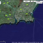
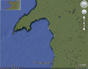
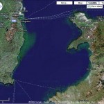
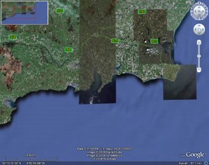
Frank, just alerted me to the new rendering Google have released for Google Earth of the Ocean Floor. Strangely I keep wanting to shout FAIL! Sure at the broadest sense – viewing the globe as a whole it looks quite nice, if a little fuzzy, but once start zooming into coastline, the matching is just a mess. The new lighter blue just sort of fades out the old darker blue. Have to say even Frank doesn’t seem convinced…

Admittedly I not really into ocean travel so the probably higher resolution doesn’t really interest me, so that puts it at a disadvantage from my point of view. Hopefully they can vastly improve the edge matching, aka the coastline, then I wont mind.

Ok so it wasn’t perfect before, having a greenish area – but it just looks like algae. But the new doesn’t look natural somehow.

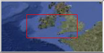
Another issue (oh dear), is the new lighter blue around the UK, is a closer to shade of land. And in the overview map – example below, I can’t even see Wales, and most of England and France etc is pretty indistinct – making the overview map fairly worthless. (disclaimer: I am red/green colour blind)

Overall: E- (sorry)

Between a rock and a hard place…

Monday, December 8th, 2008

This is going to be a long and rambley piece about licences and the updated updated Terms of Service of the Google Maps API – if either of those don’t interest you turn away now :)

Not that long ago Google updated the Terms of Service on Google Maps API – I guess mainly in responce to issues brought up on the Mail group, and elsewhere. As a result of that edit there where many concerns raised (and more)- and a further edit was made. (note, only linked to some of the blogs etc – follow links to read more) This was over a week ago, but due to non online commitments haven’t really had a time to follow this up. You can read my early reaction here, which has been edited in to Mikes post.


Below is the main section that is still causing concern, quoted in its entirety:

11. Licenses from You to Google.

11.1 Content License. Google claims no ownership over Your Content, and You retain copyright and any other rights you already hold in Your Content. By submitting, posting or displaying Your Content in the Service, you give Google a perpetual, irrevocable, worldwide, royalty-free, and non-exclusive license to reproduce, adapt, modify, translate, publicly perform, publicly display and distribute Your Content through the Service and as search results through Google Services. This license is solely for the purpose of enabling Google to operate the Service, to promote the Service (including through public presentations), and to index and serve such content as search results through Google Services. If you are unable or unwilling to provide such a license to Your Content, please see the FAQ for information on configuring your Maps API Implementation to opt out.

11.2 Brand Features License. You grant to Google a nontransferable, nonexclusive license during the Term to use Your Brand Features to advertise that you are using the Service.

11.3 Authority to Grant Licenses. You confirm and warrant to Google that you have all the rights, power and authority necessary to grant the above licenses.

To be honest still unsure how I feel about this section, and finding it very hard to vocalise (well to put to pixels) the concerns. I certain its not compatible with a number of situations where the Maps would otherwise be ideal, but that I guess is real life – just need to move on an find something that is more suitable. But its still gauling to have invested so much in Google Maps API to have it all disappear in puff of legal smoke, I guess its now going to be“Once Burnt, Twice Shy” as they say.

(more…)
Over one MILLION Geograph Images!

Wednesday, October 15th, 2008

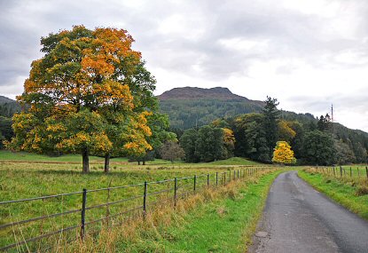
Geograph has just reached a pretty significant milestone, we how have over 1,000,000 images live on the site, all creative commons licenced for reuse goodness. The image that took us over the tipping point is reproduced below, but it is but one image of a million, so thanks to all the amazing contributors that has made this milestone possible. 


by Dr Richard Murray

Minor road near Aberuchil

 © Copyright Dr Richard Murray and licensed for reuse under this Creative Commons Licence.

Update, In the Press: Offical (login required) (RSS), Paul’s Blog, Boing Boing, Reddit, and Digg

(more…)

Geograph: Watching the Fire build

Wednesday, August 13th, 2008

Coverage Animation As we near the Million mark on photos uploaded to Geograph British Isles, the coverage is really building up; and the project has definitly matured from just capturing a photo of every square (but that is still continuing!), to capturing each square in ‘depth’. We display the current coverage on the site as a depth map, but here we present some animations to watch the progress.

There are a number of interesting artefacts in this, if you are quick you can follow people as the hike long distance paths, but you can also see the people making concerted efforts to knock of hectads.

Of course the raw frames are available under Creative Commons, and a bonus prize to who can make an good mashup of these. The animations include both weekly frames, and monthly versions (labelled quick)

(the fire reference)

Depth Key

Edit your MyMap container

Saturday, August 9th, 2008

Small update to the My Maps support in GoKML, announced a few days ago; you can now edit the links contained in the file. Just goto your secret admin page, generated for your link.

People viewing your file in Google Maps will see the update soon, Google Maps caches it for a while.

People viewing in Google Earth however will not, as they downloaded a static file, which brings onto another point, if want them to auto update as well, could create a network link to your Container, using the standard GoKML form, (enter the url your container and choose appriate refresh period).