Archive for August, 2008

Content on Google somehere, somehow?

Saturday, August 16th, 2008

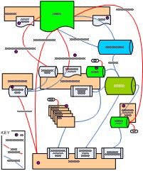
I don’t know if anyone is interested in this stuff, but have been for a long time being trying to make sence of the various ‘geo’ properties operated by Google and quite a bit on how to get indexed and exposure for your content.

Update: There has been some misconception about what this diagram represents – it is only intended to cover getting content in KML/KMZ files on your website listed and indexed in Google Properties. It’s sort of murky in that content you submit to other websites are sort of included to show they end up in various indexes. It does not cover business listings at all which for the most part is sepetate totally. 


GeoIndex Overview Diagram

GeoIndex Overview Diagram

Links for the purple circles:

  1. http://www.nearby.org.uk/gadget-for-kml.php
  2. http://code.google.com/apis/kml/documentation/kmlSearch.html
  3. http://maps.google.com/ig/submit?synd=mpl&pid=mpl
  4. http://earth.google.com/submit.html
  5. http://maps.google.com/support/bin/answer.py?hl=en&answer=68480
  6. http://earth.google.com/gallery/index.html
  7. http://www.panoramio.com/help#about_GE
  8. http://bbs.keyhole.com/

probably incomprehensible, but hopefully useful to someone? Questions or feedback welcome.

Update: notable perhaps for its exclusion, is Outreach – Oops, version 2 perhaps?
Geograph: Watching the Fire build

Wednesday, August 13th, 2008

Coverage Animation As we near the Million mark on photos uploaded to Geograph British Isles, the coverage is really building up; and the project has definitly matured from just capturing a photo of every square (but that is still continuing!), to capturing each square in ‘depth’. We display the current coverage on the site as a depth map, but here we present some animations to watch the progress.

There are a number of interesting artefacts in this, if you are quick you can follow people as the hike long distance paths, but you can also see the people making concerted efforts to knock of hectads.

Of course the raw frames are available under Creative Commons, and a bonus prize to who can make an good mashup of these. The animations include both weekly frames, and monthly versions (labelled quick)

(the fire reference)

Depth Key

Edit your MyMap container

Saturday, August 9th, 2008

Small update to the My Maps support in GoKML, announced a few days ago; you can now edit the links contained in the file. Just goto your secret admin page, generated for your link.

People viewing your file in Google Maps will see the update soon, Google Maps caches it for a while.

People viewing in Google Earth however will not, as they downloaded a static file, which brings onto another point, if want them to auto update as well, could create a network link to your Container, using the standard GoKML form, (enter the url your container and choose appriate refresh period).

My Maps Container

Wednesday, August 6th, 2008

When using the Google’s My Maps feature you can display multiple maps at once simply by ticking the boxes, however the ‘Link to this Map’ will only ever include 1 map, so you can’t easily send a group of maps to someone.

… So a new script – this time under the gokml.net banner – for creating a ‘container’ KML that simply opens a bunch of maps at once – this KML is openabe in Google Earth, but also you can share the link so others can see your batch of My Maps at once in Google Maps.

Create a KML container for a group of My Maps


As a total aside I notice My Maps, now sport a (Geo)RSS feed :)

Google Earth 4.3: Magnetic Compass

Friday, August 1st, 2008

A while ago released a Compass Overlay, which (hopefully) makes reading directions of the navigation control easier. Well this new version does the same, but its (mostly) correct for the Magnetic Direction!

Magnetic Compass correct link this time!!

Note: its positioned to fit the navigation control of Google Earth 4.3, not the separate compass, which has only recently begun working for me… Updates a few seconds after stopping moving.

Now have a way to determine the magnetic variation at a location have some other ideas for using this in Google Earth, eg magnetic bearing along a line, but this is a starting point. For example in the uk the variation is often too small to be really seen on the tiny control.

Thanks to heywhatsthat.com for the pointer to a webservice that gives the variation.

Update: Rather embarrassingly just noticed the link above was wrong! It was to a static compass. The link above has been updated, and it should now rotate! Sorry for confusion… (always wondered why this didnt get much traffic!)