Archive for April, 2009

Where in British Isles are people viewing photos?

Friday, April 24th, 2009

view-depth1-9
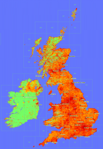
In a similar vain to the maps produced here, now that Geograph British Isles has a view counter for each and every photo, we can plot maps of viewing. :)

This map is obviouslly heavily influenced by where photos have actully been submitted; s for comparison here is a depth map of photo submissions.

Don’t know what it means, or if actully useful, but sure is pretty!


(click the thumbnail to see 1px per km scale version)

Directions to My Maps finally!

Thursday, April 23rd, 2009

Google has just added a new feature to Google Maps to save a set of directions into a My Map! This makes obsolete a popular script on ere :)

But they have gone a step further! This screenshot probably explains it best

nice.

(via)

Warning: it seems the ‘Save to My Maps’ overwrites the previous content of a My Map, not append like I would expect :(
Edit: maybe its only temporally, if it happens to you, try disabling and reenabling the map – see comments.

is it ScenicOrNot?

Saturday, April 4th, 2009

ScenicOrNot

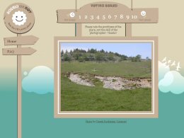
ScenicOrNot is a new mashup from the good people at mySociety – with the simple aim of finding the scenic spots across Great Britain; I’ve no idea what the super secret purpose of this site is, but they have promised to release the data, so it could be used in lots of exciting ways… 


Oh and of course the photos are sourced from Geograph British Isles.

Go rate a grid square now! Also at http://digg.com/u18iG