Archive for the ‘Nearby’ Category

Google Earth Version Stats (Mar’07)

Tuesday, March 6th, 2007

A while ago I compiled statistics of the versions of Google Earth in use in the wild (well technically accessing network links at nearby.org.uk) – well an updated version is now available.

For comparison here is the version from last Sept.

Conclusion: GE3 is definitely on the way out, but still actively used. A large number of people haven’t updated their GE4 for a while, and there might be a new version coming out sometime soon.

Update: It turns out my simplistic test for useragents beginning with kh_ missed off Mac and Linux clients – so here is a another updated version that does include such clients. Thanks to a commenter on Gearthblog for spotting this!
(I could rerun the above reports but see little point)

Update 2: It seems the new version was incorrectly calculating the total for Mac/Linux users – updated the link in the update above to correct this.

KML (& NetworkLink) for Nearby & any Geo-WordPress!

Saturday, February 17th, 2007

Following the addition of GeoRSS, earlier today while out photographing some PhotoSpots (TBA), I had an even better (possibly) idea, now that my WordPress stores Lat/Long, why not output KML too! The icing on the cake is you can also wrap it in a NetworkLink so that peoples Google Earth will auto update. (I am surprised couldn’t find this done already!)

And if that isn’t enough then I also release the code under GPL :) – note its the first time written anything for WordPress, so might not be a tidy as could be!

Anyway see it in action on my series of PhotoSpots:

- as all these list the PhotoSpot category, each post includes a link to open the actual spot, so just click the world icon in the balloon to open :)

Download the Source or view the source: WordPress KML Generator and NetworkLink Wrapper

Installation: This is not a proper plugin, so just drop the .php files into the root of your WordPress folder and you should be done (but you can configure the icon to display if you wish by editing the wp-kml.php file)

Use: Normally you would only provide a link to the Wrapper – which in turn links to the feed itself, but the feed is useful like in the above example to plot directly on Google Maps. You can also specify a particular category to display like the above example or otherwise will include all geocoded posts.
Important: Requires the GeoPress extension be installed (to get geocode info)
Only tested on WordPress 2.0.1 – Works For Me – Your Mileage May Vary – no guarantee, implied or otherwise

Another PhotoSpot

Friday, January 26th, 2007


View at Geograph: SH7840 : Stone on Carnedd Iago
Another in the mini-series of Panoramic Images loaded into Google Earth, using DigitalUrban‘s Panoramic Viewer tutorial.

This one is higher resolution than some of the others and ways in at 525kb,
but the extra resolution is useful to see the distant mountain ranges.

Anyway download it here: Google Earth Version

geotagged More Links for this location

Pen-y-Garn Mountain Panorama for GE

Tuesday, January 23rd, 2007

Following the nice spell of weather thought it an excellent opportunity to capture some images to create another Google Earth PhotoSpot (I still don’t think there is an official name for these).

Pen y Garn Panorama

Download the Google Earth Version (262kb KMZ file).

Used in the making of this: AutoPano*, Paint Shop Pro, DigitalUrban Panorama viewer for GE, (of course) Google Earth, a SpaceNavigator and Winzip 10#.

* (demo version, hence the watermark, first time used but really good, just got to make a usecase to someone to buy it for me ;)

# using Winzip to create the KMZ file seems to manage to squeeze some compression out of the jpg itself :)

Mountain Panorama in Google Earth

Monday, January 15th, 2007

DigitalUrban, has for a while being working on a Panorama Viewer for Google Earth, well to prove that it doesn’t just apply to Urban settings, I have created this panorama of the Top of Snowdon Google Earth File, the highest mountain in Wales (and England).

Really impressive! Just in case you don’t have a SpaceNavigator to really explore, have created a few views, just double click to move around. (idea from Google Earth Blog – except I used folders, so don’t have icons).

To really enjoy the feel of the mountains, I recommend setting your Terrain Exaggeration setting to about 2.0, although having said that the included Snapshot views are designed for when TE is set at 1, as that’s probably the most common.

I should note that I scaled up the model, to make it easier to use, so it does leave a rather large blob on top of the hill! This is also only a rectilinear panorama, rather than spherical, so it will be nice if DigitialUrban can work in support for such images.

geotagged More Links for this location

UK ZIPScribble Map

Saturday, January 6th, 2007

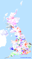
UK ZipScribble MapFollowing inspiration from the US ZIPScribble Map, I have created a UK version. Due to the resolution of the Postcodes in the UK it doesn’t work that well with full postcodes, but using sector postcodes seems to work well, click the thumbnail for a higher resolution version. (yes know some Postcode areas are missing!)

I have split and changed colour between postcode area (the first 1,2 letters), otherwise the sorting is done in alphanumeric order.

(via eagereyes.org blog)

Network Link updates

Friday, December 15th, 2006

Following on from the last post about the amazing 3D SpaceNavigator (PE) from 3dconnexion, it has finally inspired me to blow the dust off the experimental solution to Making a View-Based Refresh efficient when tilted?, that I blogged about a while ago.

So I’ve just implemented this on the Geograph Google Earth ‘Wide Area’ Network Link, and the Nearby NetworkLayers, (imaginative names aye?), which along with GB and Ireland Grid Lines Layers any my most used network links.

This should have no affect when looking ‘straight down’ but when the globe is tilted, hopefully the useful information should be better positioned in the foreground rather than extending into the blurry distance.

Feedback welcome…

Landranger Coordinates

Thursday, December 7th, 2006

Not sure if this really deserves a post of its own, but it is mildly exciting to delve back into the Perl of the Coordinate converter

Anyway it can now understand ‘Landranger References’ which are common in some walking books (that’s the main place I seen them anyway!), basically where just the digits of a Grid reference are specified along with a Landranger sheet number.

Example: OS52 894334 which is 894334 on Landranger sheet 52, converted to NN894334 as a standard Grid Reference.

Placemarks Grouped and Sorted

Tuesday, October 17th, 2006

I’ve had a request to be able to sort the output of the KML Grouper, so … well… now you can! Enjoy.

Making a View-Based Refresh efficient when tilted?

Wednesday, October 11th, 2006

I guess this only is really of interest to Google Earth network link builders… And rather that rewrite again what I wrote on the GEC, will quote the juicy bit and then provide a link (laziness!)

 ” As is probably common I use the BBOX returned during a refresh of a View-Based refresh to return some results to the user.

This works well when the view is directly overhead as there is very little wastage and the bbox represents the region of interest quite well.

However as soon as the view is tilted it becomes less useful as lots of the bbox is wasted in encompassing the distant area toward the horizon. “

I then go on to discuss my potential solution, add a demo and a link to the source, hopeing that somebody else is working or at least thinking of something similar…

View post here