ClassyGMaps

April 29th, 2015

In the time honoured tradition, of kinda resurrecting closed down Google products, heres another..

ClassyGMaps

Its the start of an attempt to recreate Classic Google Maps. But not far beyond a prototype yet.

It can already display KML files, split screen streetview, and 45-degree aerial imagery, three things lost in ‘New Maps’.

Its on GitHub:
https://github.com/barryhunter/classygmaps/

and has its own issue tracker:
https://github.com/barryhunter/classygmaps/issues

If want it to develop, post your requests!

Update: Added two new map types, a live emulation of UK road colour scheme (works worldwide!), and access to legacy map tiles, from before Google changed the colour scheme. I dont think the tiles will be updated to include new roads etc, but might be interesting to get a decent colour scheme.

Resurrecting the Google KML Embed and Tour Gadgets

September 16th, 2014

Long time since posted here, but just wanted somewhere to record links to these tools:

Fake KML Embed Gadget

and

Fake KML Tour Gadget

They are replicas of the KML Gadgets that Google used to offer (they disappeared with the demise of iGoogle). Was able to save the code and get them working again, if you already have embeds on your site, should just be able to make a small change to the code to get the gadgets working again – more detailed instructions the above pages.

Bulk/Batch coordinate converter

July 26th, 2012

A revival of this blog to add a link to a new online tool…

Batch Coordinate Converter

Very barebones, but it should work for converting many coordinates in some columnar text format (eg CSV)

Can convert to/from OSGB easting/northings and Grid References, dito for the Irish Grid, and WGS84 decimal lat/long.

All done in javascript, so should be reasonably quick, and no formal limit to the number of conversions it can do – although of course it will be slow to do a really large number.

Geograph Javascript Playgrounds

July 1st, 2011


I often have little ideas for new ways to display images from Geograph, but its a pain building prototypes.

It usually involves finding some other part developed prototype or feature, that I can use as a template. Then have start up a code editor, and get connected to a server. Think of a name to call the file. Strip out the bits not needed for the new application. Then have to remind myself the APIs available. Work out how to call the APIs etc, etc, etc.

… well now I’ve began work on a platform to make this easier. Online code editor – quick forking of current projects. Easy wrapped access to relevant APIs, jQuery already loaded.

No more worrying about what to call the file, or making sure I keep backups of previous versions (should want to find a previous one!). This is all handled automatically. Setup to handle browser caching and invalidation on new versions. No worrying about stale code.

It’s primarily for my own use, but thought may as well open it up so others can use it build quick prototypes – or even fully fledged applications (based on Geograph images of course!).

The applications created all run client-side in browser – so utilizes the power of jQuery to create immersive and compelling interfaces.

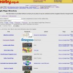
Probably the best place to start is from a few of the early demos I built with the system:

Public Listed Applications

Please use them as starting points – or simply inspiration to build your own application! (They are not meant as complete applications!)

No special tools required – other than a browser. Firefox with Firebug, or Chrome (press F12!) recommended – to help catch javascript errors.

(note: it only wraps one Geograph API currently – loading all images in a gridsquare – more to be added)

Geograph Channel Islands is back!

February 10th, 2011

Sorry all for the extended outage on Geograph Channel Islands site. It used to share servers with Britain and Ireland, but that caused a number of stability issues. (caused mainly by a bug in APC I believe!)

Anyway, we are now hosted on CatN‘s vCluster platform.
CatN is by the same people who provide colocation hosting for Geograph, so the move isn’t actually far (both Geographically, and Virtually ;) .

Separating Channel Islands site into a more standalone project, should hopefully also make the site easier to manage – and give more flexibility to grow.

(Next project is moving Geograph Portals to vCluster too, but I’m going to have do some more work on the code first)

Want a copy of the Geograph Archive? (by snail mail)

January 8th, 2011

For the past few months I have been sending out copies of the Geograph Archive (all of it!) on USB hard disks.

If you are interested then let me know, plan to make an order for blank hard disks early next week.

I plan to offer these at £60 a piece – postage to the UK included. Depending on postage worldwide, might be slightly more, quote on request. Which is pretty close to cost.

The drives will be 640G, and include about 490Gb of jpgs. (about 2222222 files) The database and code is included, but that can also be downloaded from online. Probably these.

… With an added twist, will send it completely free (I’ll finance it myself) if you promise to make an application to view the images off the disk (ie works entirely offline). This would have be Open Source so it could be included on future disks, and downloadable for holders of disks already). More details of this on request.

Preservation of the Google Maps Directory

December 18th, 2010

Recently Google deprecated Mapplets, which are little applications that ran on Google Maps. They have also now removed the Google Maps Directory.

However its still possible to run mapplets by a dedicated page (well at least for as long as V2 of the Google Maps API exists) – but no listing of mapplets available within Google Maps.


But fear not, I captured a copy of the mapplet list, and created a small crawler to fetch the details from the mapplets, and present them in a little searchable application:

Replacement Mapplet Directory

Admittedly the quality of the applications in the directory where always kinda variable, but there is some real gems in there, so at least preserving a listing I think is worthwhile, so they can be accessed if needbe.

Historic OS Maps in Google Earth

November 8th, 2010

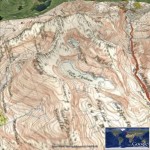
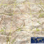
Thanks to the people at getmapping.com, who have taken the Historic 1940s OS Maps available at NPEmap.org.uk, I hearby present:

Historic OS Map layer for Google Earth.

This loads up a layer of Historic New Popular Edition (mainly) maps, onto the 3D Google Earth globe. This is made possible because the original maps are over 50 years old and hence the Crown Copyright has expired.

The getmapping.com WMS service only includes (Most of) England and Wales, no Scotland.

The scans themselves are (c) npemap.org.uk and licenced under this Creative Commons Attribution-NonCommercial Licence 2.5.

(Don’t forget to select the ‘OS Map’ layer, and drag the transparency slider!)

Anybody want to run Geograph Channel Islands?

October 25th, 2010

A while ago I started putting together a sister project to Geograph Britain and Ireland (and Geograph Germany!); a dedicated project for the Channel Islands.

It ‘freeloaded’ on the back of the Britain and Ireland project and shared the same servers. Alas that is no longer sustainable, and causing issues to the other projects hosted there.

So looking for someone to step up and help with the administrative and hosting. It needs new hosting.

I believe it could fit in the free trial offer from Amazon http://aws.amazon.com/free/ – at least initially (for a year).

Would you be willing to signup? And look after raising funds to pay for it. That could be though ads, donations or sponsorship etc.

It doesnt have to be though Amazon, if can get reasonable hosting elsewhere.

I’ll take care of getting the site running in the new location, and provide lo-fi support to keep it running (the techy stuff). Just can’t justify the administration.

(Contact me via Geograph)

‘Select Search’ Chrome extension – now with added Geograph

October 15th, 2010

Jérémie, the developer of the ‘Select Search’ Chrome extension has just added support for Geograph.

The extension hovers a small set of icons when select text on a webpage. So that can search for that text on a verity of services.

Extension Page

Will need to enable Geograph in the Extension Options. Of course there are a verity of other sites it can search :)