Archive for the ‘Google Maps’ Category

URLsnipper for Google URLs

Tuesday, March 31st, 2009

I am often copy/pasting links to Google searches – particully on Google Maps. Nearly every time I have to hand edit the URL – mainly as I KNOW a large proportion is redundant. Quite frankly a long url is scary, and others know it too. 

Anyway so I created a little script for my own use to cut down the URL automatically:

URLsnipper for Google URLs

It has a good understanding of Google Maps URLs, and reasonable for Google Web search, so it makes a fair attempt at deducing unneeded bits, however it also provides tickboxes to truely customise the result to your own taste :)

Example (a fairly mundane one)

will add support for other urls at some point, blogsearch, news etc. 


Partly inspired by this

Leaky and verbose URL parameters…

Wednesday, February 18th, 2009

Disclaimer: this post is a rant – turn away now!

I can’t keep quiet about this any longer, its getting me more and more annoyed. Google Maps includes a “Link” function – which creates a link to the current map, which is very useful – particully as the map is estentially ‘ajax’ style, but the parameters are definitly starting to suffer rot and lack of ‘love’ in maintaining them.

For example to just display a simple KML file, you get this corker:

http://maps.google.com/maps?f=q&source=s_q&hl=en&geocode=&q=http:%2F%2Fwww.geograph.org.uk%2Ffeed%2Frecent.kml&g=Any+Street,+London,+UK&ie=UTF8&ll=55.053203,-3.208008&spn=17.762194,33.793945&z=5

There are so many things wrong with this url, its unreal. The first is the source – doesnt do
anything as far as I can see, an empty (but immensely useful) geocode, etc; but somewhat ironically I have HAD to edit the url provided by the function before I was willing to post it here, see that g param – yes that’s my (now made up!) home address.

Yes thats right, if you not careful Google Maps might get you to inadvertently share your home address – seriouslly WTF!

(more…)

MGRS coordinate entry

Friday, December 12th, 2008

Prompted by one of those infernal* posts on a Google Maps group, have finally been inspired to cobble together a MGRS -> Lat/Long conversion. It seems trvial, the UTM->MGRS conversion is quite simple, but there are a few gotchas!, so after much puzzleing over some C code from GeoTrans (and Trial&Error for good measure!), I think** have something working.

Anyway try it out here: 

Coordinate Flyto for Google Earth/Maps

also added today is a tickbox to open the result direct in Google Maps (rather than Google Earth). 

I’ll tidy it up and post the code, which is based on the PHPcoord conversion class, incase others have a use. I’ll also add it to the API – and possibly even back port it into Perl for use on the on site coordinate covertor. 

Finally possibly of interest is the realisation that the MGRS Google Earth Gridlines layer, will actully load directly in Google Maps, so:

MGRS Gridlines in Google Maps

the lines should update a few seconds after dragging/zooming. Ideally will suppress the big blue pins (which are show as numbers in GE) , but not tonight…


* in the nicest possible sence!

** I tested it by converting utm->mgrs->utm globally on a worldwide 1 degree grid – all check out with absolute precision.

Between a rock and a hard place…

Monday, December 8th, 2008

This is going to be a long and rambley piece about licences and the updated updated Terms of Service of the Google Maps API – if either of those don’t interest you turn away now :)

Not that long ago Google updated the Terms of Service on Google Maps API – I guess mainly in responce to issues brought up on the Mail group, and elsewhere. As a result of that edit there where many concerns raised (and more)- and a further edit was made. (note, only linked to some of the blogs etc – follow links to read more) This was over a week ago, but due to non online commitments haven’t really had a time to follow this up. You can read my early reaction here, which has been edited in to Mikes post.


Below is the main section that is still causing concern, quoted in its entirety:

11. Licenses from You to Google.

11.1 Content License. Google claims no ownership over Your Content, and You retain copyright and any other rights you already hold in Your Content. By submitting, posting or displaying Your Content in the Service, you give Google a perpetual, irrevocable, worldwide, royalty-free, and non-exclusive license to reproduce, adapt, modify, translate, publicly perform, publicly display and distribute Your Content through the Service and as search results through Google Services. This license is solely for the purpose of enabling Google to operate the Service, to promote the Service (including through public presentations), and to index and serve such content as search results through Google Services. If you are unable or unwilling to provide such a license to Your Content, please see the FAQ for information on configuring your Maps API Implementation to opt out.

11.2 Brand Features License. You grant to Google a nontransferable, nonexclusive license during the Term to use Your Brand Features to advertise that you are using the Service.

11.3 Authority to Grant Licenses. You confirm and warrant to Google that you have all the rights, power and authority necessary to grant the above licenses.

To be honest still unsure how I feel about this section, and finding it very hard to vocalise (well to put to pixels) the concerns. I certain its not compatible with a number of situations where the Maps would otherwise be ideal, but that I guess is real life – just need to move on an find something that is more suitable. But its still gauling to have invested so much in Google Maps API to have it all disappear in puff of legal smoke, I guess its now going to be“Once Burnt, Twice Shy” as they say.

(more…)

Use Google Maps API to display data? Your data has been POWNED

Thursday, November 13th, 2008

If you use Google Maps API to display data on our website, then beware; new Terms of Service have been introduced. And it doesn’t look good…

Basically its laid out pretty clearly (see section 11.1) that if you use the API to display *your* data, then you grant Google a irrevocable licence to do as it sees fit with your data.

Sure it says “You retain copyright and any other rights you already hold in Your Content. ” – first, to soften the blow, but then goes on to say “[to] publicly perform, publicly display and distribute Your Content… ” (click the above link to see the full text) – I dont see how that is any different to saying they can do what they like with your data.

It gets worse if you have “business listings data”, as 11.1(b) says: “For example, if you create a store locator application, Google may use the business listings information from the store locator to improve the Google Services such as Google Maps and local search.
- give your data away free to Google why don’t you!

then as 11.3 says “Authority to Grant Licenses. You confirm and warrant to Google that you have all the rights, power and authority necessary to grant the above licenses.” – in many cases I* don’t think I can!

So does that mean if I can’t grant the licence demanded, I can’t use the Maps API? It seems so to me, so its with a heavy heart have had to disable some API based maps and Mashups. At least in the short term.

* as the one agreeing to the Maps API Terms Of Service.

(more…)

Grid References on Google Maps

Saturday, September 27th, 2008

I made this ages ago, but forgot about it. And as I havent said anything on here for a while, I’ll post it now just to fill the void. Its a simple mapplet that allows jumping to the location on Google Maps by Grid reference, as well as displaying the GR of the clicked point. KISS

GB and Ireland Grid References Mapplet

Thanks to Lordelph for the Javascript (but I notice that links to a version hosted here!)

Content on Google somehere, somehow?

Saturday, August 16th, 2008

I don’t know if anyone is interested in this stuff, but have been for a long time being trying to make sence of the various ‘geo’ properties operated by Google and quite a bit on how to get indexed and exposure for your content.

Update: There has been some misconception about what this diagram represents – it is only intended to cover getting content in KML/KMZ files on your website listed and indexed in Google Properties. It’s sort of murky in that content you submit to other websites are sort of included to show they end up in various indexes. It does not cover business listings at all which for the most part is sepetate totally. 


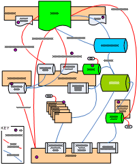
GeoIndex Overview Diagram

GeoIndex Overview Diagram

Links for the purple circles:

  1. http://www.nearby.org.uk/gadget-for-kml.php
  2. http://code.google.com/apis/kml/documentation/kmlSearch.html
  3. http://maps.google.com/ig/submit?synd=mpl&pid=mpl
  4. http://earth.google.com/submit.html
  5. http://maps.google.com/support/bin/answer.py?hl=en&answer=68480
  6. http://earth.google.com/gallery/index.html
  7. http://www.panoramio.com/help#about_GE
  8. http://bbs.keyhole.com/

probably incomprehensible, but hopefully useful to someone? Questions or feedback welcome.

Update: notable perhaps for its exclusion, is Outreach – Oops, version 2 perhaps?

Edit your MyMap container

Saturday, August 9th, 2008

Small update to the My Maps support in GoKML, announced a few days ago; you can now edit the links contained in the file. Just goto your secret admin page, generated for your link.

People viewing your file in Google Maps will see the update soon, Google Maps caches it for a while.

People viewing in Google Earth however will not, as they downloaded a static file, which brings onto another point, if want them to auto update as well, could create a network link to your Container, using the standard GoKML form, (enter the url your container and choose appriate refresh period).

My Maps Container

Wednesday, August 6th, 2008

When using the Google’s My Maps feature you can display multiple maps at once simply by ticking the boxes, however the ‘Link to this Map’ will only ever include 1 map, so you can’t easily send a group of maps to someone.

… So a new script – this time under the gokml.net banner – for creating a ‘container’ KML that simply opens a bunch of maps at once – this KML is openabe in Google Earth, but also you can share the link so others can see your batch of My Maps at once in Google Maps.

Create a KML container for a group of My Maps


As a total aside I notice My Maps, now sport a (Geo)RSS feed :)

Google Earth: Chart Plotter

Sunday, July 27th, 2008

Did someone mention a chart plotter? If so have a look-see:

Google Earth: Map Plotter

Its hot off the presses so don’t know what options it will need yet, just used three example zooms levels – other options would include the mobile map style. (You can change it by altering the link in Properties)

Also its standard Google Maps, as that is all the API offers. Ideally would be proper flight plan data, but would need a Static Map API to work.

Note: The map is centered on the camera position (so is ideal for the Flight Simulator) – and while it can be used in other modes it wont make much sense. If interest could make one that shows the center of the view itself.

Disclaimer: this is entering the gray area of what is possible with the Static Maps API, so might get pulled, etc.

More flight sim tools